The number is fixed: 14. Only fourteen mountains on Earth pierce the 8,000-meter barrier, the altitude where the atmosphere thins so severely that human cells begin to die faster than they regenerate. Climbers call this zone the Death Zone, and every one of these giants sits inside it.
This guide ranks all fourteen by verified elevation, breaks down each summit's character, and gives you honest context on what it takes to even stand at their base.
What Defines an 8,000-Meter Peak?
An eight-thousander is any mountain whose summit exceeds 8,000 meters (26,247 feet) above sea level with sufficient topographic prominence. All 14 are concentrated in two ranges: the Himalayas (spanning Nepal, India, Tibet, Bhutan) and the Karakoram (spanning Pakistan and China).
The list was formalized by mountaineering authorities in the mid-20th century. Reinhold Messner completed the first full circuit in 1986, and as of 2026, fewer than 50 climbers have repeated the feat without bottled oxygen.
The 14 Tallest Mountains in the World - Complete Ranking
Here is the definitive ranked list, from highest to lowest, with verified elevations, country locations, and the year of first successful ascent.
Rank
Mountain
Height
Country
First Ascent
1
Mount Everest
8,848.86 m
Nepal / Tibet
1953
2
K2
8,611 m
Pakistan / China
1954
3
Kanchenjunga
8,586 m
Nepal / India
1955
4
Lhotse
8,516 m
Nepal / Tibet
1956
5
Makalu
8,485 m
Nepal / Tibet
1955
6
Cho Oyu
8,188 m
Nepal / Tibet
1954
7
Dhaulagiri I
8,167 m
Nepal
1960
8
Manaslu
8,163 m
Nepal
1956
9
Nanga Parbat
8,126 m
Pakistan
1953
10
Annapurna I
8,091 m
Nepal
1950
11
Gasherbrum I
8,080 m
Pakistan / China
1958
12
Broad Peak
8,051 m
Pakistan / China
1957
13
Gasherbrum II
8,035 m
Pakistan / China
1956
14
Shishapangma
8,027 m
Tibet (China)
1964
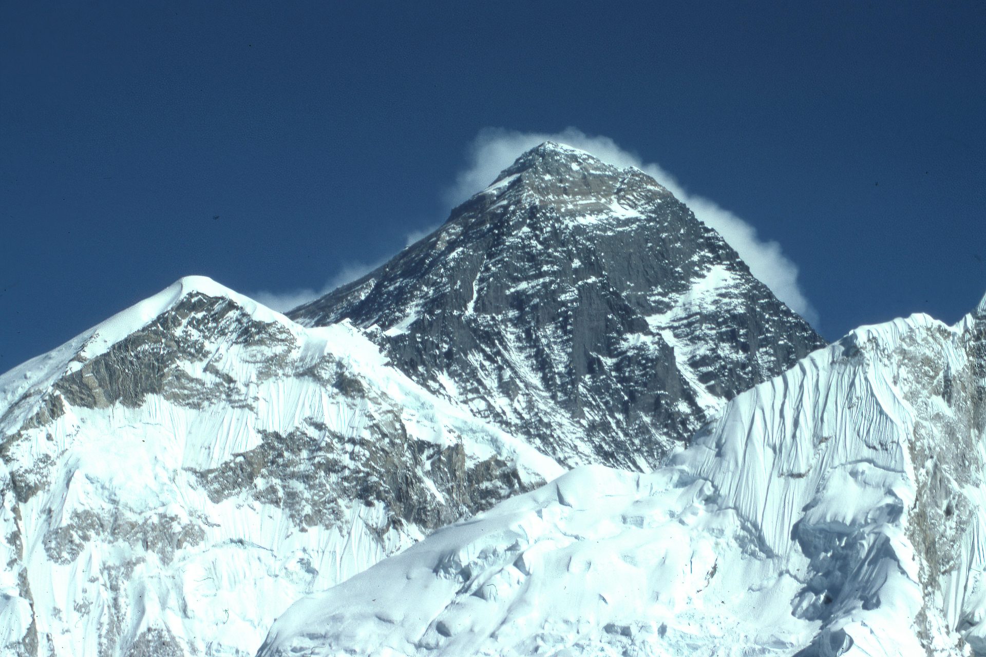
1. Mount Everest — 8,848.86 m
Source: Dick Hoskins, Panoramic view of Mount Everest summit and the surrounding Himalayan mountain range.
Mount Everest is the highest point on Earth at 8,848.86 meters, straddling the border between Nepal's Khumbu region and Tibet. First summited by Sir Edmund Hillary and Tenzing Norgay on May 29, 1953, it now sees over 600 summits per season via the Nepal side.
The local Sherpa name is Sagarmatha, while Tibetans call it Chomolungma. South-side expeditions launch from Everest Base Camp at 5,364m, accessed via the Lukla flight. which during peak seasons (March–May, Sept–Nov) operates from Manthali Airport in Ramechhap, requiring a 4–5 hour pre-dawn drive from Kathmandu.
The standard climbing permit for foreigners on the Nepal side currently costs $15,000 USD in the spring season. Trekkers (not climbers) only need the Sagarmatha National Park Permit (NPR 3,000)plus the Khumbu Pasang Lhamu Municipality fee (NPR 3,000).
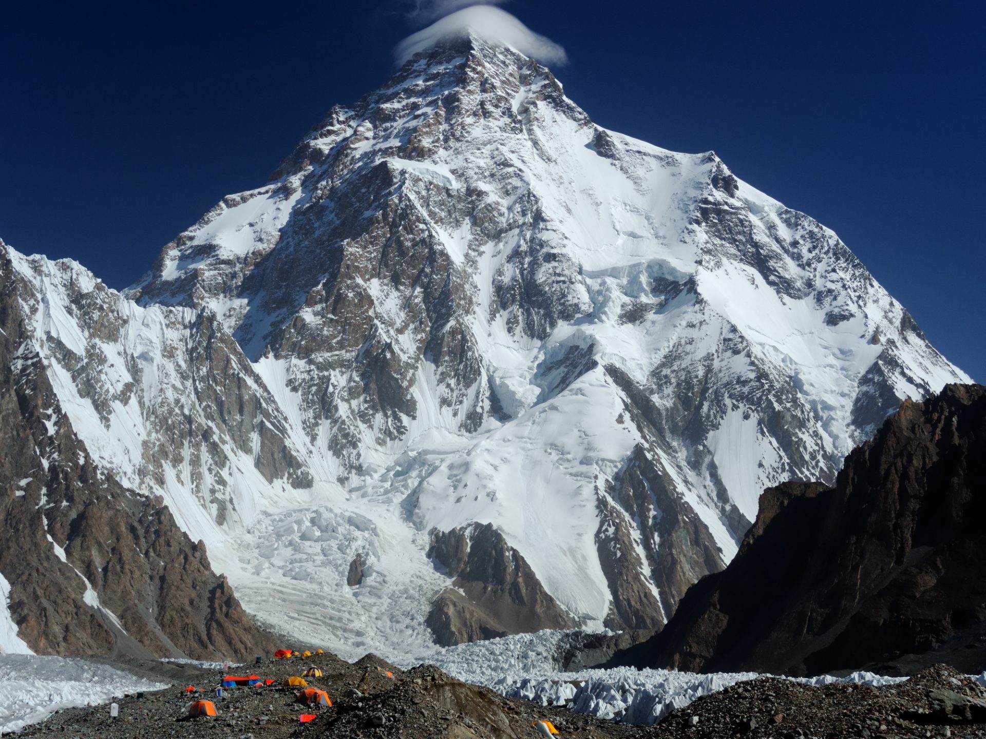
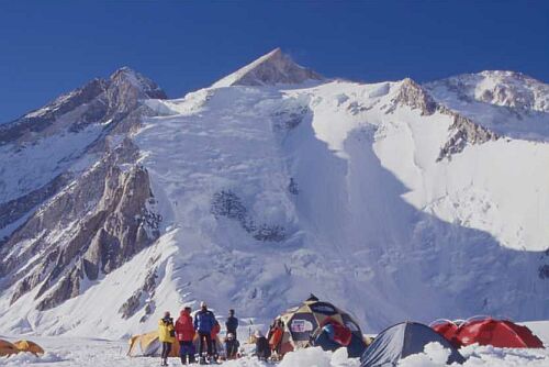
2. K2 — 8,611 m
The steep, icy pyramid peak of Mount K2 mountain during a clear day.
K2, also known as Mount Godwin-Austen or Chhogori, rises to 8,611 meters in the Karakoram range on the Pakistan-China border. It is the second-highest peak but widely considered the most technically savage to climb, with a historical fatality rate near 25%.
Unlike Everest, K2 has no easy route. Its pyramidal shape forces climbers up steep ice and rock from every direction. The standard approach trek from Askole to K2 Base Camp at 5,150m takes 7–8 days across the Baltoro Glacier.
3. Kanchenjunga — 8,586 m
Source: Arvind Telkar, Majestic snow-capped peaks of Mount Kanchenjunga, the third-highest mountain in the world.
Kanchenjunga stands at 8,586 meters on the Nepal-India border in far-eastern Nepal. Its name means "Five Treasures of Snow," referencing its five distinct summits. Local communities consider it sacred, by tradition, climbers stop just short of the true summit out of respect.
Trekking to Kanchenjunga Base Camp (5,143m) is a restricted-area journey of 20–24 days. Under the March 2026 regulations, a licensed guide is mandatory, with a maximum ratio of 1:7.
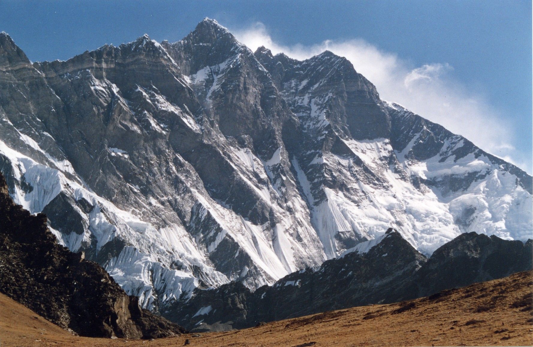
4. Lhotse — 8,516 m
Majestic south face of Mount Lhotse viewed from the Chukhung Ri trekking viewpoint.
Lhotse, at 8,516 meters, shares the South Col with Everest, making the two technically connected. Most climbers approach via the same Khumbu Icefall route until Camp 3. The legendary Lhotse Face is a 1,125-meter wall of blue ice angling at 40–50 degrees.
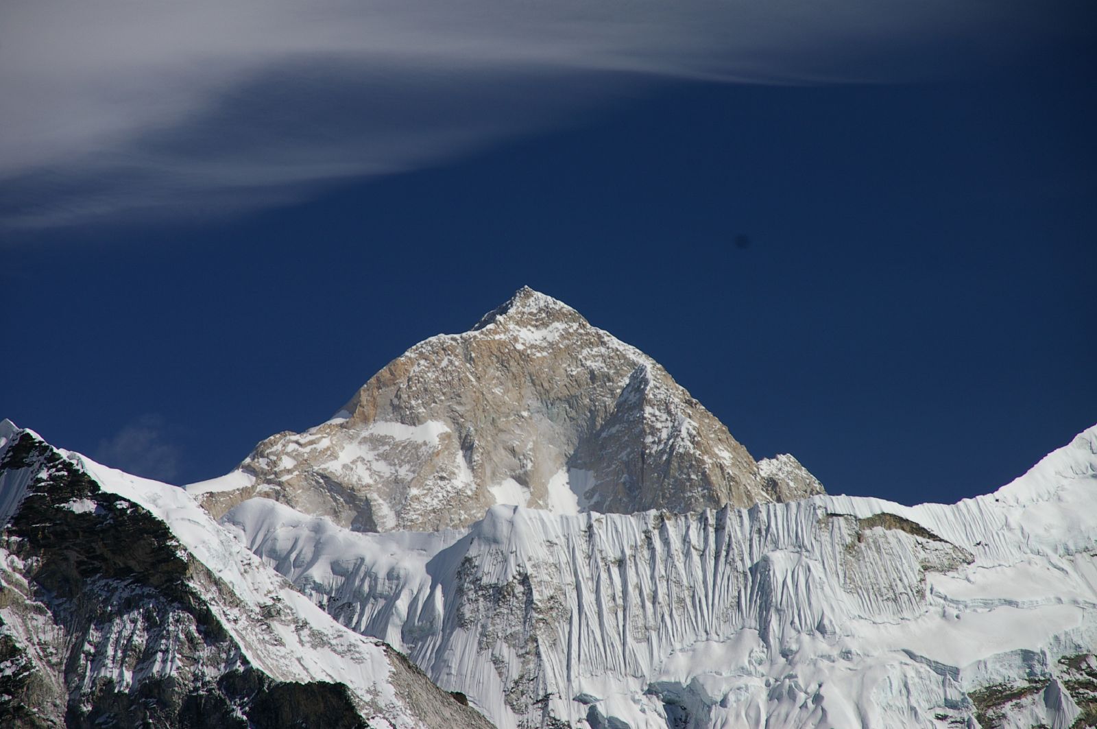
5. Makalu — 8,485 m
The iconic isolated four-sided pyramid peak of Mount Makalu in the Himalayas.
Makalu is a stark four-sided pyramid rising to 8,485 meters, located 19 km southeast of Everest. The Makalu Barun National Park surrounding it remains one of the least visited high-mountain wildernesses in Nepal.
The trek to Makalu Base Camp (4,870m) takes around 18 days round trip and crosses the demanding Shipton La pass. Cell coverage along this route relies heavily on Nepal Telecom (NTC).
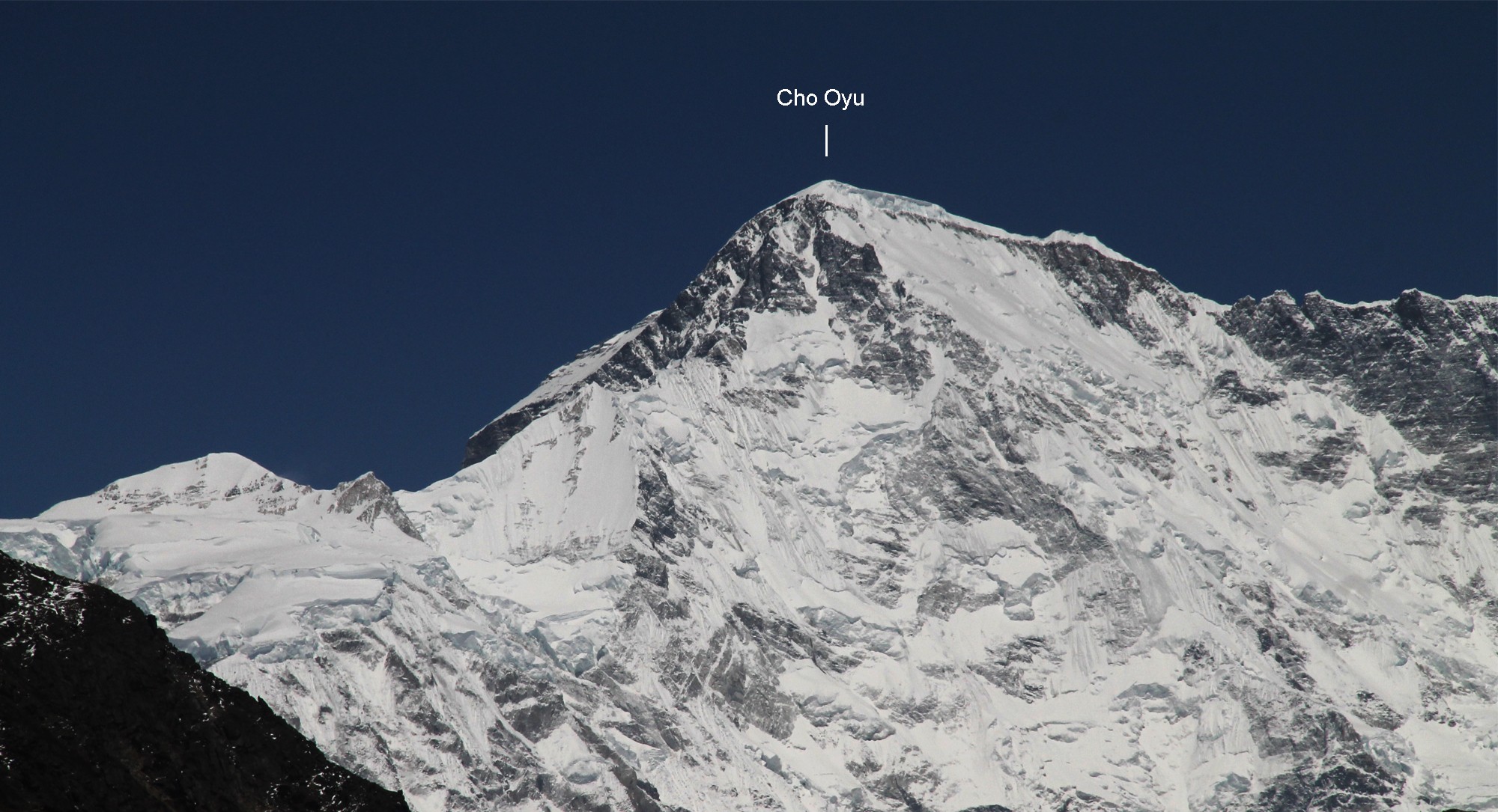
6. Cho Oyu — 8,188 m
Source: Sanjib Gurung, Snow-covered summit of Mount Cho Oyu, the sixth-highest mountain in the world.
Cho Oyu, the "Turquoise Goddess," measures 8,188 meters and sits about 20 km west of Everest on the Tibet border. It is considered the most accessible 8,000er, with a non-technical northwest ridge that has made it the most popular eight-thousander for first-timers attempting altitude above 8,000m.
7. Dhaulagiri I — 8,167 m
Aerial mountain view of Mount Dhaulagiri peak from an expedition flight in Nepal.
Dhaulagiri means "White Mountain" in Sanskrit. At 8,167 meters, it dominates the skyline west of Pokhara and was, briefly in 1808, believed to be the highest mountain in the world.
The Dhaulagiri Circuit Trek takes 18–21 days, crossing the high French Pass (5,360m) and Dhampus Pass (5,240m). It is a fully camping expedition, no teahouses exist on the high sections. Trekkers must hire a licensed guide and porters through a registered agency.
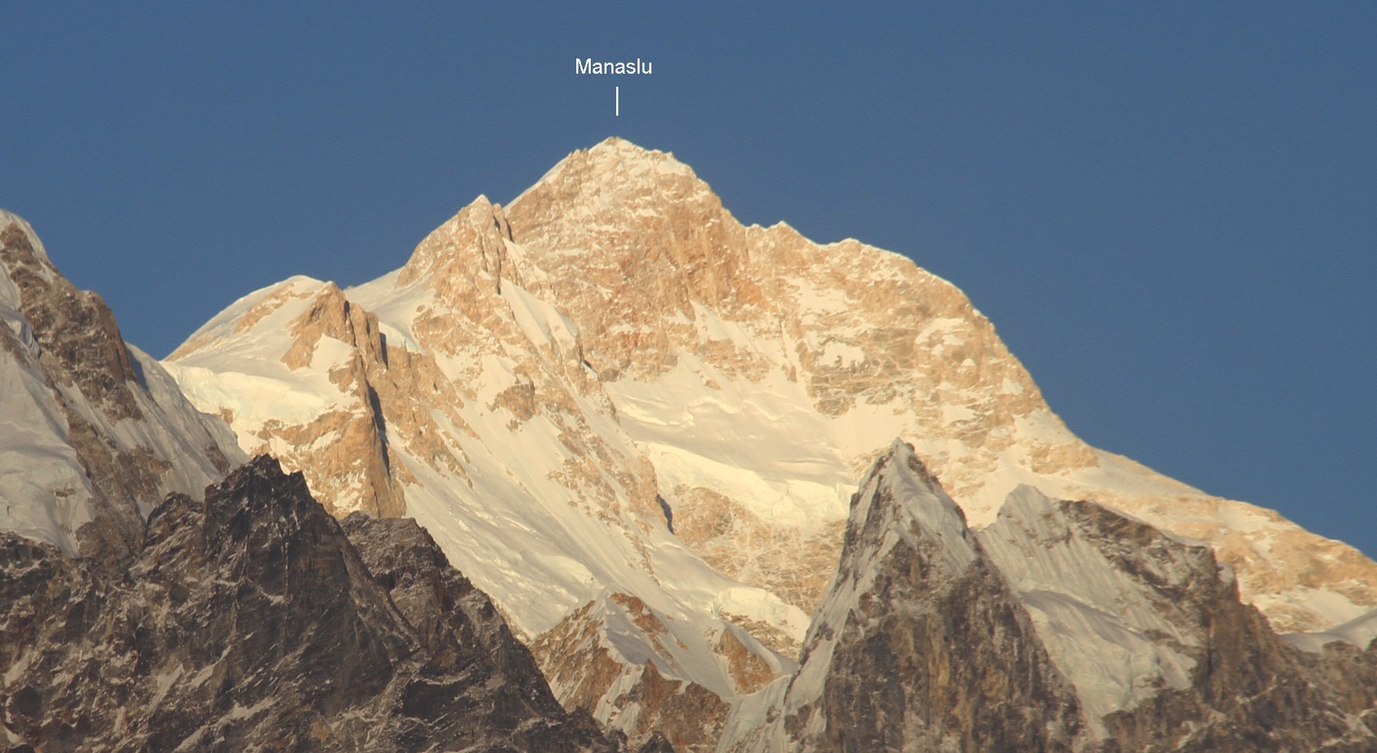
8. Manaslu — 8,163 m
Source: Sanjib Gurung, The striking, pointed twin peaks of Mount Manaslu rising above the clouds in Nepal.
Manaslu, the "Mountain of the Spirit," rises to 8,163 meters in west-central Nepal. The Manaslu Circuit Trek has become Nepal's premier alternative to Annapurna, crossing the iconic Larkya La Pass at 5,106m.
Manaslu lies in a Restricted Area. Under 2026 rules, a single traveler can now obtain the permit (the old 2-person minimum has been removed) but must hire a licensed guide. The RAP fee is $100 USD per person for the first 7 days in peak season (Sept–Nov), plus the MCAP and ACAPpermits at NPR 3,000 each and the Chum Nubri Municipality fee (NPR 1,000).
Note that the lower circuit now has jeep roads on long sections, we always advise trekkers to take the alternative walking trails (NATT routes) to avoid dust and vehicle traffic.
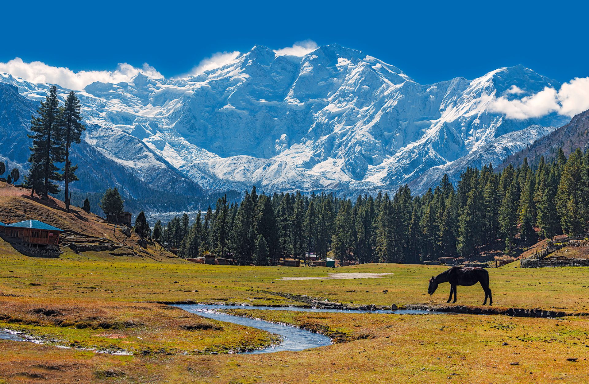
9. Nanga Parbat — 8,126 m
Green alpine meadows of Fairy Meadows looking toward the massive north face of Nanga Parbat.
Nanga Parbat, the "Naked Mountain," rises to 8,126 meters in Pakistan's Gilgit-Baltistan. Its south face, the Rupal Face, is the tallest mountain wall on Earth at over 4,600 meters from base to summit. It earned the historical nickname "Killer Mountain" before its first ascent in 1953.
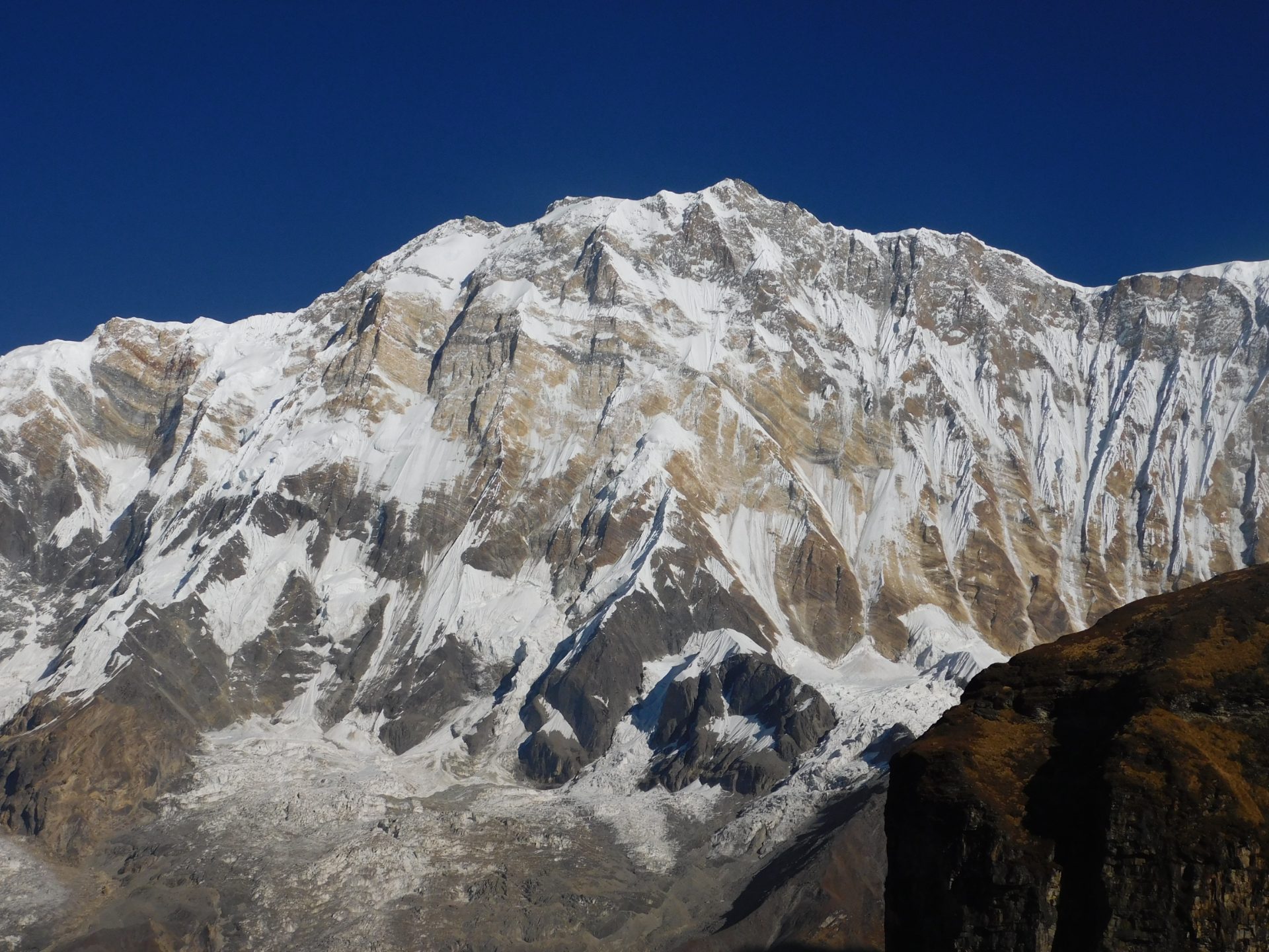
10. Annapurna I — 8,091 m
The massive, icy South Face of Annapurna I viewed from the Annapurna Sanctuary trail.
Annapurna I, at 8,091 meters, was the first 8,000er ever climbed, summited by Maurice Herzog and Louis Lachenal on June 3, 1950. It also holds the grim distinction of the highest historical fatality ratio of any eight-thousander, approximately 32%.
Trekkers don't climb the summit, but the Annapurna Base Camp Trek to 4,130m is one of Nepal's most beloved routes, taking 7–12 days. The required ACAP permit costs NPR 3,000. For the Annapurna Base Camp Trek, the traditional standalone TIMS card requirement has faced rolling structural shifts due to local municipal counter-rules. However, for the Manaslu Circuit, because it is a restricted area, a TIMS card is not required at all, the Restricted Area Permit (RAP) entirely supersedes it.
11. Gasherbrum I — 8,080 m
Remote, snow-covered peak of Gasherbrum I, also known as Hidden Peak, in winter.
Gasherbrum I, also called "Hidden Peak," stands at 8,080 meters deep in the Karakoram. Its remote position means it cannot be seen from any inhabited area, hence the name. Climbers approach via the same Baltoro Glacier trek as K2.
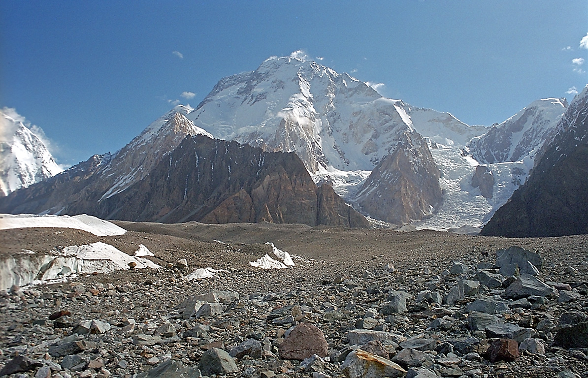
12. Broad Peak — 8,051 m
Massive snow-capped summit ridge of Broad Peak in the Karakoram mountain range.
Broad Peak, at 8,051 meters, sits just 8 km from K2 and gets its English name from its 1.5-kilometer-wide summit ridge. First climbed in 1957 by an Austrian team in true alpine style, no porters, no oxygen, no fixed ropes.
13. Gasherbrum II — 8,035 m
Source: Simple Wikipedia, Sharp icy ridge and pyramid summit of Gasherbrum II mountain in the Karakoram range.
Gasherbrum II rises to 8,035 meters and is widely regarded as the most achievable of the Karakoram eight-thousanders. Its southwest ridge offers a relatively safer line, and it has become a popular target for climbers attempting their first Karakoram summit.
14. Shishapangma — 8,027 m
High altitude panoramic view of Mount Shishapangma peak in the Tibetan Himalayas.
Shishapangma, at 8,027 meters, is the only 8,000er located entirely within Tibet (China). It was the last of the fourteen to be climbed, finally summited in 1964 by a Chinese expedition. Access requires a Chinese climbing permit and a Tibet travel authorization.
Technicality Check: Is Everest Truly the Tallest?
While Mount Everest is universally recognized as the highest mountain on Earth based on its elevation above sea level, changing the metric shifts the crown to two completely different peaks.
1. Tallest from Base to Peak: Mauna Kea (USA)
If you measure a mountain from its absolute geological base to its highest tip, Mauna Kea, a dormant volcano on the Big Island of Hawaii, is the tallest mountain on Earth.
The Reality: Mauna Kea rises 4,207 meters above sea level, which seems modest compared to the Himalayas. However, its base sits on the deep ocean floor.
The Scale: From its submarine base in the Hawaiian Trough to its snowy peak, Mauna Kea measures a staggering 10,205 meters, surpassing Mount Everest by over 1,350 meters.
2. Closest to Space (Farthest from Earth's Center): Mount Chimborazo (Ecuador)
If your definition of "highest" means the point on the Earth’s surface that reaches farthest out into the cosmos, the title goes to Mount Chimborazo in the Andes of Ecuador.
The Reality: Our planet is not a perfect sphere; the centrifugal force of Earth's rotation creates an equatorial bulge, making the planet thicker at the equator than at the poles.
The Scale: Because Chimborazo sits just one degree south of the equator, it gets a massive geographic "boost." Even though its sea-level elevation is only 6,263 meters, its peak rests 6,384.4 kilometers from the Earth's core, making its summit roughly 2.1 kilometers closer to the stars than the top of Mount Everest.
The 8 Eight-Thousanders in Nepal: A Trekker's Reality
Eight of these fourteen giants sit fully or partially in Nepal. While summiting them requires elite mountaineering credentials, base-camp trekking puts ordinary travelers face-to-face with these walls of ice and rock.
For all base-camp routes above 3,000 meters, follow the cardinal acclimatization rule: sleep elevation gain should not exceed 300–500 meters per day, with mandatory rest days at hubs like Namche Bazaar (3,440m) and Manang (3,540m).
Permits, Guides & 2026 Regulations
As of March 2026, Restricted Area Permits (Manaslu, Upper Mustang, Dolpo, Tsum Valley) no longer require a 2-person minimum, but a licensed guide remains mandatory. The guide-to-trekker ratio is capped at 1:7. Standard trekking regions (Annapurna, Everest, Langtang) also strongly enforce guide requirements, verify current rules with your operator before departure.
Mandatory Helicopter Evacuation Insurance
Standard travel insurance won't cover you on these mountains. You need a policy explicitly covering high-altitude helicopter evacuation up to 6,000m and medical treatment for AMS, HAPE, and HACE. This is legally required to obtain Restricted Area Permits.
Cash, Connectivity & Food on the Trail
ATMs do not exist past Namche Bazaar in Khumbu or Jomsom in Annapurna. Carry sufficient Nepalese Rupees in cash. Expect upcharges of NPR 200–700 for phone charging, hot showers, and Wi-Fi access (such as Everest Link) at lodges.
For food, stick to vegetarian meals. In Khumbu, slaughtering animals is prohibited by local Buddhist law, meaning meat is carried up unrefrigerated for days. Order Dal Bhat, lentil soup, rice, and vegetable curry, for clean, high-energy fuel with free refills at most teahouses.
Sustainable Hydration
Skip the plastic bottled water. Carry a reusable bottle paired with a UV purifier, Sawyer squeeze filter, or chlorine dioxide drops. Many regions including Khumbu have banned plastic water bottles outright.
Cultural Etiquette in Sacred Mountain Country
These mountains aren't just geography, they're deities to the communities living below them. When passing mani stones, chortens, and stupas, always keep them to your right (pass on the left). Walk clockwise around all religious structures.
Remove shoes and hats before entering monasteries. Photography inside prayer halls is prohibited unless a resident monk grants explicit permission. At the end of your trek, tipping your crew 15%–20% of the total trek cost (distributed among guides and porters) is the cultural standard and a critical part of their income.
The Monsoon Exception
If you want a Himalayan trek during summer (June–August), the rest of Nepal is wet and leech-ridden, but Upper Mustang and Upper Dolpo sit in the Himalayan rain shadow. These zones stay dry and trekkable, offering the only summer window to walk among the world's high peaks.
Frequently Asked Questions
How many mountains in the world are above 8,000 meters?
There are exactly 14 mountains on Earth with summits above 8,000 meters. All sit in the Himalayan and Karakoram ranges across Nepal, China (Tibet), Pakistan, and India.
Which is the deadliest of the 14 eight-thousanders?
Annapurna I in Nepal holds the highest historical fatality-to-summit ratio of all 8,000-meter peaks at approximately 32%, primarily due to extreme avalanche risk on its south face.
How many of the 14 highest mountains are in Nepal?
Eight of the fourteen eight-thousanders are located fully or partially in Nepal: Everest, Kanchenjunga, Lhotse, Makalu, Cho Oyu, Dhaulagiri I, Manaslu, and Annapurna I.
Can a regular trekker (non-climber) see these mountains up close?
Yes. Trekkers can reach the base camps of Everest (5,364m), Annapurna (4,130m), Manaslu, Dhaulagiri, Makalu, and Kanchenjunga with strong fitness and proper acclimatization. No technical climbing skills are required.
Who climbed all 14 eight-thousanders first?
Italian mountaineer Reinhold Messner became the first person to summit all 14 eight-thousanders in 1986 — and he did so without supplemental oxygen on any of them.
What is the cheapest 8,000m peak to attempt?
Cho Oyu and Manaslu are typically the most affordable, with full expedition costs ranging widely depending on operator and service tier. Always verify live pricing with your registered Nepal-based agency.