
Arati Dawadi
At 5,416 meters, the wind on Thorong La Pass doesn't whisper, it shoves. The air carries roughly half the oxygen of sea level, your fingertips lose sensation through three glove layers, and the silhouette of Yakawa Kang rises like a frozen wall against a sky so blue it looks artificial. This is the moment Annapurna Circuit trekkers train, suffer, and dream for. And it's harder than the brochures suggest.
Our field coordinators have run this route in every season, watched the trail evolve from a remote mule track into a partly-jeeped corridor, and tracked every permit reshuffle through 2026. What follows is the operational truth about crossing one of the world's highest regularly trekked pass, not a travelogue, but a working manual you can plan against.
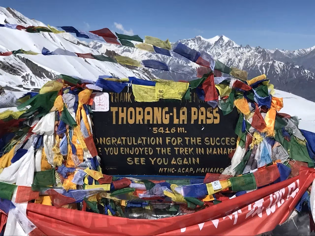
A signboard congratulating climbers on reaching the thorong la pass.
Thorong La Pass connects the Manang Valley to the Mustang district across a glaciated saddle at 5,416 meters. Thorong La is one of the highest and most famous non-technical trekking passes in the Himalayas, crossed annually by thousands of trekkers on the Annapurna Circuit. What makes it difficult isn't technical climbing, but the combination of extreme altitude, exposure, brutal pre-dawn wind chill, and the sheer physical demand of summit day. The challenge comes from extreme altitude, a long 7-9 hour summit day, and brutal pre-dawn wind chill.
The difficulty isn't technical. There are no ropes, no crampons in good weather, and no glacier crevasses to negotiate. What breaks people is the combination of thin air and stamina demands on summit day, when you start hiking at 4:30 AM from High Camp, climb roughly 490 vertical meters to the pass, then descend an exhausting 1,600 meters to Muktinath on tired legs.
The October 2014 blizzard, triggered by Cyclone Hudhud, killed 43 people in the Annapurna region, including 21 trekkers on the Circuit, making it Nepal's deadliest trekking disaster on record. The disaster permanently changed how guides, lodges, and trekking agencies approach weather awareness on Thorong La. Responsible operators now monitor forecasts far more carefully and enforce stricter turnaround decisions during unstable conditions. Today, guides monitor weather windows obsessively, and our team mandates turnaround protocols if visibility drops below safe thresholds at High Camp.
The ultimate guide to planning your dream web travel adventure with the experts from myeasyguide.
Spam free. Unsubscribe anytime. We respect your privacy.
For the Annapurna Circuit with Thorong La Pass, the primary required permit is the ACAP (Annapurna Conservation Area Permit), which costs NPR 3,000 for most foreign trekkers and NPR 1,000 for SAARC nationals.
The TIMS system has become inconsistent in the Annapurna region as of 2023. Some agencies still issue digital TIMS registrations linked to your guide and insurance, while many checkpoints now verify only ACAP permits in practice. Regulations continue evolving through 2026, so trekkers should confirm the latest enforcement status with their registered trekking agency before departure.
One rule that is consistently enforced operationally: foreign trekkers are expected to trek with a licensed Nepali guide arranged through a registered agency. Checkpoints increasingly request guide details and QR-linked permit records.
Permits are typically issued in Kathmandu at the Nepal Tourism Board office or in Pokhara near Damside. Bring passport copies, photos, and travel insurance documentation.
For tourist visa fees on arrival at Tribhuvan International Airport: $30 USD for 15 days, $50 USD for 30 days, and $125 USD for 90 days.
Visa fees can usually be paid in major foreign currencies or by card at Tribhuvan International Airport, though carrying clean USD cash remains the safest backup.
Standard travel insurance is not sufficient. You need a policy that explicitly covers high-altitude trekking up to 6,000 meters and emergency helicopter evacuation. Most professional trekking agencies now require proof of high-altitude evacuation insurance before confirming a Thorong La itinerary. A medical evacuation from High Camp to Kathmandu can cost $5,000-$8,000 USD, uninsured trekkers have been bankrupted by single rescue flights.
The full Annapurna Circuit traditionally began in Besisahar, but jeep roads now extend deep into the valley. We recommend a hybrid approach: drive to Dharapani or Chame to skip the dusty lower section, then walk the high-value cultural and alpine zones. The NATT (New Annapurna Trekking Trails) markers route you onto quiet forest paths parallel to the road wherever possible.
Road construction has permanently changed parts of the lower Annapurna Circuit, particularly between Besisahar and Manang, but the NATT side trails still preserve many quieter walking sections away from vehicle traffic.
Some trekkers argue the road construction diminished the classic Annapurna Circuit experience, while others appreciate the improved logistics and emergency access. The best modern itineraries use side trails strategically to avoid vehicle-heavy sections wherever possible.
Flights between Jomsom and Pokhara are highly weather dependent and frequently delayed by mountain wind conditions. Build buffer time into your Nepal itinerary.
Source: Neha Maheen Mahfin
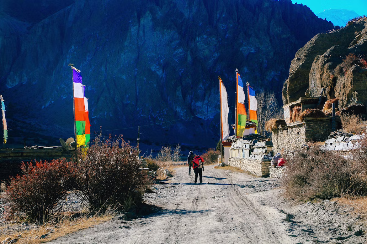
Trekkers on their way to thorong la pass.
Above 3,000 meters, sleep elevation must not increase by more than 300-500 meters per day. Manang at 3,540 meters is the mandatory acclimatization stop. Skip this rest day, and your odds of altitude sickness triple. Climb high, sleep low, hike to Ice Lake or Gangapurna viewpoint, then return to Manang to sleep.
The Himalayan Rescue Association runs a free daily altitude lecture in Manang at 3:00 PM during peak seasons. Attendance is essentially mandatory in our books, the HRA doctors explain AMS, HAPE, and HACE symptoms with the kind of clarity that saves lives.
Mild AMS feels like a hangover: headache, nausea, and sleep disturbance. This is normal up to a point. The red flags are confusion, ataxia (loss of coordination), wet cough, or breathlessness at rest. These indicate HAPE or HACE, both fatal within hours if you continue ascending.
Our guides carry pulse oximeters and check oxygen saturation every morning above 4,000 meters. Experienced guides monitor oxygen saturation trends alongside symptoms, hydration, pace, and coordination rather than relying on pulse oximeter numbers alone. There is no negotiating this protocol.
Source: Wikipedia
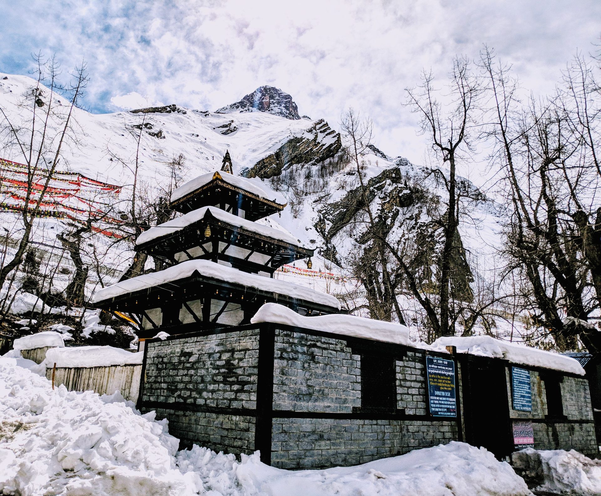
The sacred Muktinath Temple complex, a famous pilgrimage site in Mustang, Nepal.
Wake-up at High Camp comes at 3:30 AM. You eat a light breakfast of porridge and tea by headlamp, force down water you don't want, and step into the cold around 4:30 AM. The early start is essential, afternoon winds at the pass routinely exceed 60 km/h and can ground even experienced trekkers.
The first two hours climb a series of frozen switchbacks. Your headlamp beam catches the breath of the trekker ahead, frozen instantly into ice crystals. Pace is everything. Take 50 steps, breathe for 20 seconds, repeat. Guides call this the rest step, and it's the only sustainable rhythm at this altitude.
You'll reach the pass between 7:30 AM and 9:00 AM. The prayer flags shred themselves in the wind. The tin sign reads "Congratulations! You made it." You'll want to stay, don't. Spend 15-20 minutes, take your photos, and start the descent. Lingering at 5,416 meters is how altitude sickness catches latecomers.
The drop to Muktinath is the hidden crusher of this trek. You lose 1,656 meters over roughly 15 kilometers on loose scree and rocky switchbacks. Knees take a hammering. Trekking poles are non-negotiable here, we've seen more injuries on this descent than on the ascent.
Muktinath itself, at 3,760 meters, is a sacred site for both Hindus and Buddhists. The temple complex contains 108 water spouts and an eternal flame fed by natural gas. Walk clockwise around the temple, and pass all mani walls on your left, keeping the structures to your right.
Source: Neha Maheen Mahfin
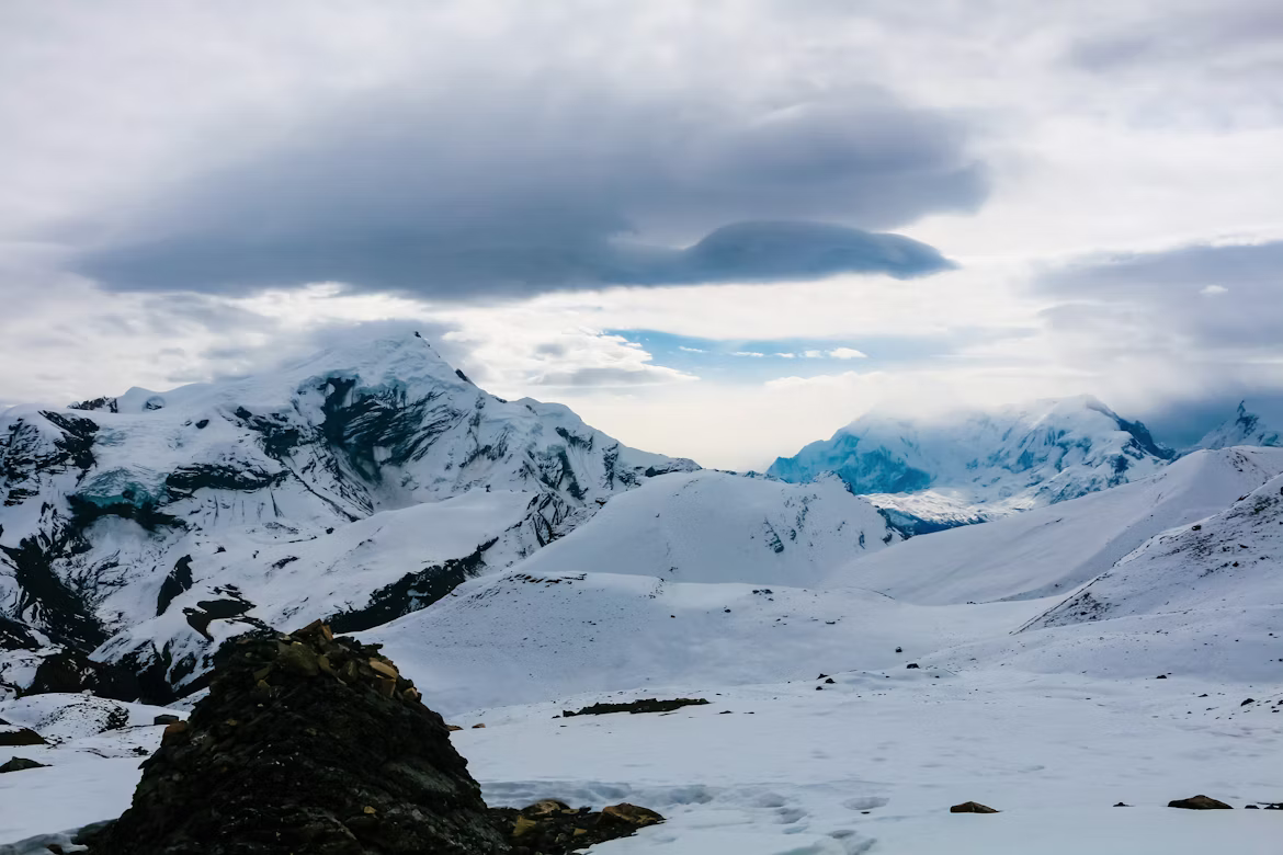
Snow covered mountains seen on the way to thorong la pass.
The premier season. Skies clear after monsoon, mountain views are razor-sharp, and trail traffic peaks. Daytime temperatures at Manang sit around 10-15°C; pass-day pre-dawn temperatures hit -15°C to -20°C with wind chill. Lodges fill fast, book ahead.
Rhododendron forests below Chame explode in red and pink. Slightly hazier mountain views than autumn but warmer and quieter on the trail. Late May brings pre-monsoon afternoon thunderstorms, start early daily.
The pass closes intermittently due to snowfall. Crossings remain possible in early December and late February with crampons and microspikes, but storm windows are short. Lodges at Phedi and High Camp often close in deep winter.
The lower Annapurna trail is leech-infested and landslide-prone. However, our coordinators consistently route monsoon trekkers toward Upper Mustang instead, it lies in the Himalayan rain shadow and stays dry. If you have summer dates, consider Mustang over Thorong La.
ATMs exist in Besisahar, Chame, and Jomsom, but assume they will be empty or offline. Carry NPR 35,000-50,000 in cash per person for a standard 12-day circuit, more if you want extra comfort.
Common trail upcharges beyond your room and meals:
Skip the bottled water entirely. Carry a Sawyer squeeze filter, a UV SteriPen, or chlorine dioxide tablets. The amount of plastic on the lower trail is genuinely heartbreaking, and refilled bottles save you significant cash over a two-week trek.
The Annapurna region is Ncell country. Pick up an Ncell tourist SIM at Kathmandu airport for around NPR 1,000-1,500 with data. Coverage runs reliably to Manang and patchy beyond. Nepal Telecom (NTC) works at some points but Ncell is the stronger choice here.
At High Camp and the pass itself, expect no signal. Inform your family of a 24-48 hour communication blackout on summit day.
The Annapurna isn't as strictly Buddhist as the Khumbu, but many experienced trekkers switch to vegetarian meals above Chame, since meat transport and refrigeration become increasingly unreliable at higher elevations.
Order Dal Bhat for lunch and dinner. The traditional lentil-rice-vegetable plate comes with free refills, packs roughly 1,000 clean calories, and is cooked fresh in every kitchen. Trail nickname: "Dal Bhat power, 24 hour." Add a fried egg, a Tibetan bread breakfast, and apple pie in Manang (genuinely excellent at the bakery near the gompa), and your fueling is handled.
You're walking through Tibetan Buddhist heartland. Pass all chortens, mani stones, and prayer wheels on the LEFT side, keeping the sacred object to your right. Spin prayer wheels clockwise as you pass.
Remove shoes and hats before entering any gompa. Photography inside prayer halls requires explicit permission from a monk. The Braga Monastery above Manang and the Muktinath temple complex deserve quiet, respectful behavior, these are working religious sites, not photo opportunities.
Tipping is culturally expected and forms a meaningful supplement to the modest base salaries paid to guides and porters. Industry standard sits at 15%-20% of the total trek cost, distributed among the crew.
Rough working numbers for a standard 12-day Thorong La trek: $120-180 USD for your guide and $80-120 USD per porter. Hand tips directly in an envelope on the final evening. Cash is appreciated in either NPR or USD.
Thorong La rewards preparation and humbles arrogance in equal measure. Trekkers who train for six months, follow the acclimatization schedule, and trust their guide rarely have trouble. Trekkers who push through symptoms or skip Manang's rest day end up in helicopters.
This is not a trek to rush. Give it 14-16 days from Kathmandu to Pokhara if you can. The standing on the pass at sunrise, with Dhaulagiri and the Annapurnas glowing pink across an ocean of valleys, is worth every cold breath it takes to get there.
Yes, at 5,416 meters, Thorong La is one of the world's highest regularly crossed non-technical trekking passes and the highest point on the Annapurna Circuit Trek. While several Himalayan passes are technically higher, few are crossed as frequently by standard tea-house trekkers
No. Since April 2023 and continuing through 2026, Nepal's current trekking framework strongly expects foreign trekkers in the Annapurna region to hire a licensed guide through a registered agency. Enforcement varies by checkpoint and season, but organized guided trekking is now considered the standard and safest approach.
Trekkers who acclimatize properly in Manang, ascend gradually, and respect altitude symptoms complete the crossing successfully far more often than those who rush the ascent. Most failures come from rushing the ascent or ignoring early AMS symptoms.
Pre-dawn crossing temperatures in autumn range from -15°C to -25°C with wind chill. Winter attempts can drop below -30°C with serious avalanche risk.
No, healthy acclimatized trekkers do not require oxygen. Your guide should carry an emergency canister and a pulse oximeter regardless.
No. ATMs exist only in Besisahar, Chame, and Jomsom and are unreliable. Carry sufficient Nepalese Rupees from Kathmandu or Pokhara for the entire trek.