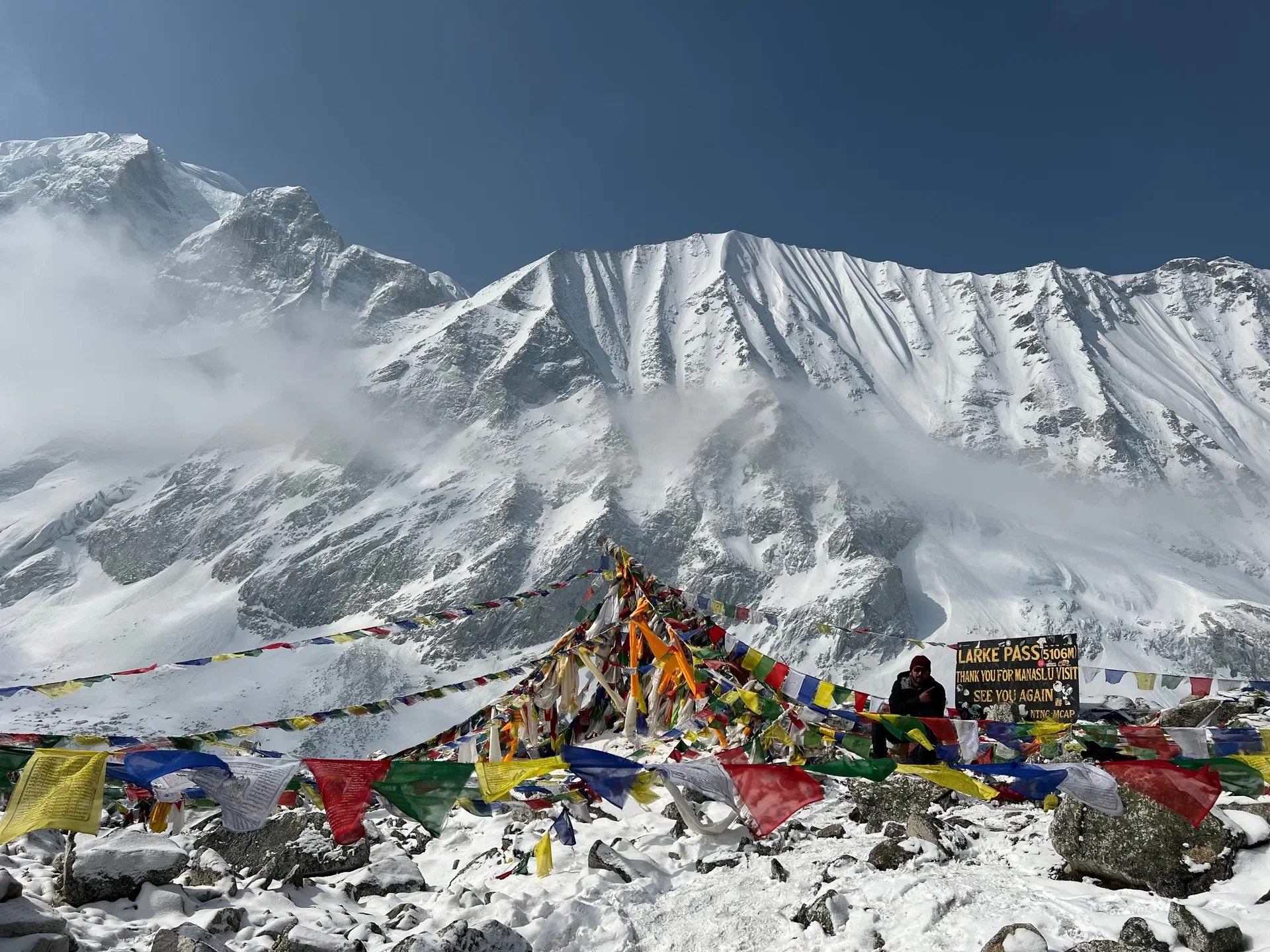
The morning you cross Larkya La starts in the dark and the cold. You leave the stone huts of Dharamsala around 3:30 to 4:00 AM, headlamp beam bouncing off frosted scree, breath fogging in front of you, and you climb slowly toward a pass at 5,106 meters where the wind off the Larkya glacier can knock the words out of your mouth. This is the high point of the Manaslu Circuit, and getting over it safely is the whole reason your itinerary was built the way it was.
We coordinate Manaslu treks year after year, and Larkya La is the section we brief travelers on most carefully. It rewards patience, good acclimatization, and an early start. It punishes rushed schedules and overconfidence. Here is everything you need to plan and walk it well in 2026.
Larke Pass at a Glance
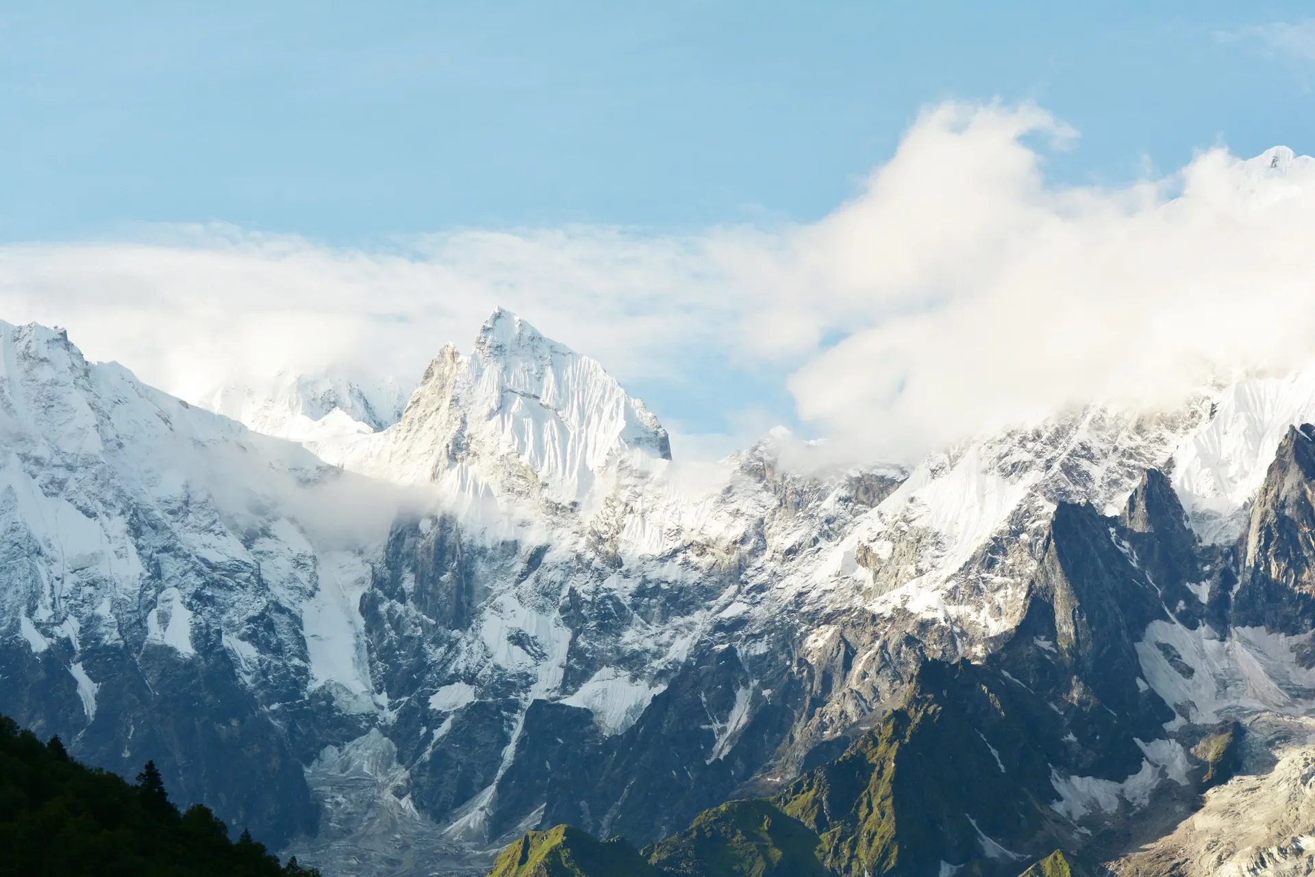
Source: Siddhartha Sen / Pexels, Eighth-highest peak: A dramatic glimpse of Mount Manaslu's jagged, icy ridges piercing through the morning clouds.
Larkya La (also spelled Larke Pass) is a high Himalayan pass at 5,106 meters, crossed on the longest single day of the Manaslu Circuit. Trekkers depart Dharamsala before dawn, climb roughly 4 to 5 hours to the prayer-flag-draped summit, then descend a steep, glacial slope to Bimthang, completing an 8 to 9 hour day over about 24 kilometers.
The pass links the Budhi Gandaki valley on the Manaslu side with the Marsyangdi valley on the Annapurna side. Views from the top take in Himlung, Cheo, Kangguru, and the Annapurna massif spilling out to the southwest. It is a thin, exposed place, and you do not linger long.
A little inspiration for your next trip
Get travel ideas and local experiences from My Easy Guide in your inbox.
Spam free. Unsubscribe anytime. We respect your privacy.
Feature
Detail
Pass elevation
5,106 meters
Start point (crossing day)
Dharamsala / Larkya Phedi (4,460m)
End point (crossing day)
Bimthang (3,720m)
Crossing day distance
~24 kilometers
Crossing day duration
8 to 9 hours
Typical departure time
3:30 to 4:00 AM
Best seasons
March–May, late Sept–Nov
Permits and 2026 Regulations
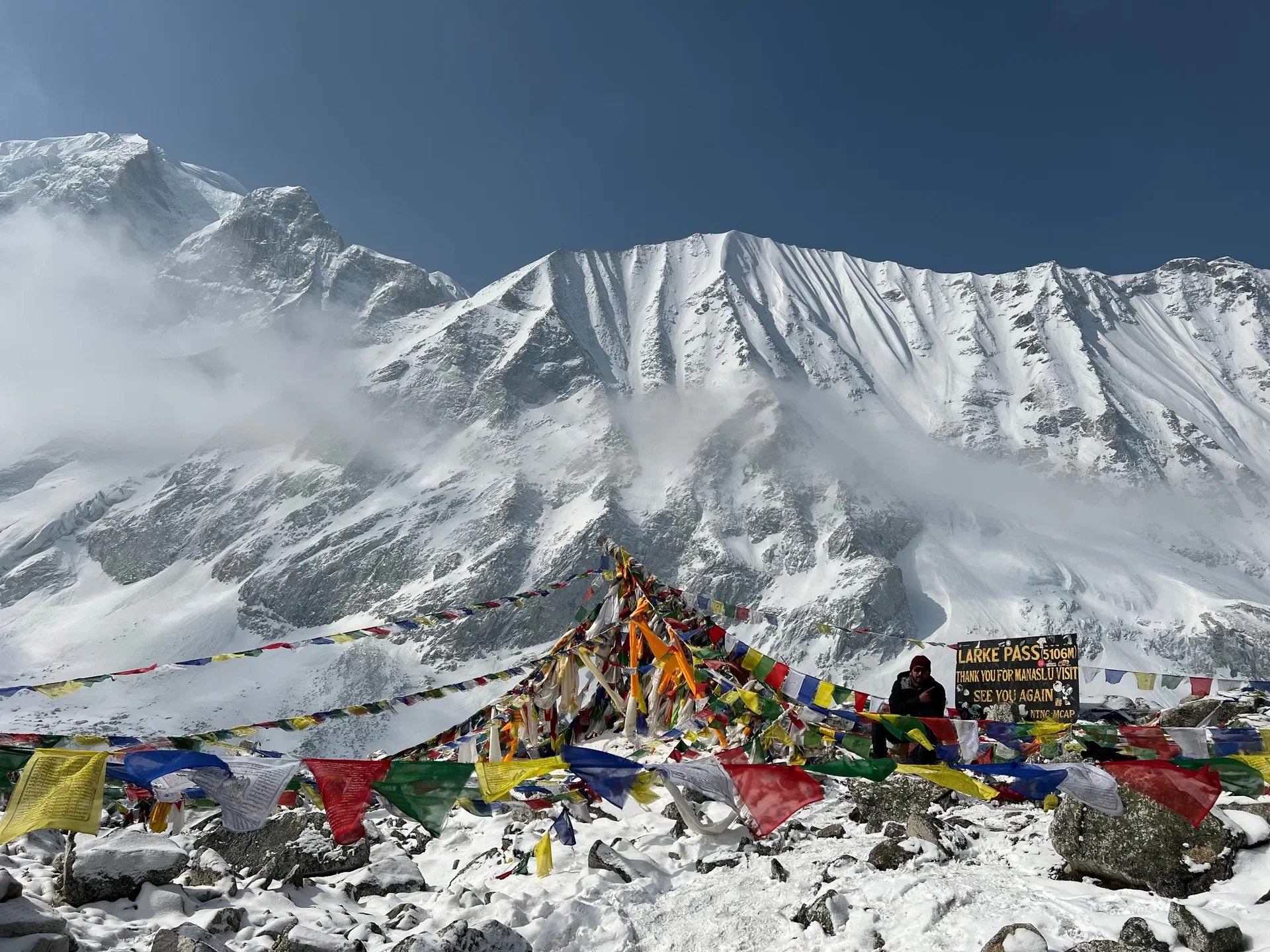
Source: Sanjay Prakash / Pexels, The highest point: Celebrating the successful crossing of Larke Pass ($5106\text{ m}$), the challenging and rewarding pinnacle of the Manaslu Circuit.
The Manaslu Circuit is a Restricted Area, so it requires three permits and a licensed guide. As of the March 2026Department of Immigration (DOI) update, a single traveler can now obtain a Restricted Area Permit, but you still cannot walk it solo. You must hire a licensed guide, and the guide-to-trekker ratio is capped at 1:7.
You will need the Manaslu Restricted Area Permit (RAP), the Manaslu Conservation Area Permit (MCAP), and the Annapurna Conservation Area Permit (ACAP), because the trail exits through Dharapani into the Annapurna region after Bimthang.
Permit Fees for 2026
The Manaslu RAP is seasonal and time-based, charged per person. Conservation permits are fixed government fees. Below are the standard rates you should budget for.
Permit
Foreigner
SAARC / Local
Manaslu RAP (Sept–Nov)
$100 USD first 7 days, then $15 USD/day
Lower seasonal rate
Manaslu RAP (Dec–Aug)
$75 USD first 7 days, then $10 USD/day
Lower seasonal rate
MCAP
NPR 3,000
NPR 1,000 (SAARC)
ACAP
NPR 3,000
NPR 1,000 (SAARC)
Chumnubri Rural Municipality Tourism Fee
NPR 1,000
NPR 1,000 (SAARC)
RAP permits are processed in Kathmandu through a registered trekking agency, not at the trailhead. Your guide and agency handle the paperwork, but carry your physical passport and several passport photos. You can read our broader breakdown of trekking rules and costs before you fly out.
Your travel insurance must explicitly cover high-altitude helicopter evacuation up to 6,000 meters and treatment for AMS, HAPE, and HACE. Standard holiday insurance is not enough, and proof of adequate cover is part of obtaining a Restricted Area Permit.
How the Itinerary Builds Toward the Pass
A safe Manaslu Circuit eases you up the Budhi Gandaki gorge before the altitude bites. Above 3,000 meters, your sleeping elevation should not rise by more than 300 to 500 meters per day, and you need at least one acclimatization rest day before the pass. We build that rest day at Samagaun.
Day
Route
Sleep Elevation
1
Drive Kathmandu to Soti Khola / Machha Khola
~870m
2
Machha Khola to Jagat
1,340m
3
Jagat to Deng
1,860m
4
Deng to Namrung
2,630m
5
Namrung to Lho
3,180m
6
Lho to Samagaun
3,520m
7
Acclimatization day (Manaslu Base Camp or Birendra Lake)
3,520m
8
Samagaun to Samdo
3,860m
9
Samdo to Dharamsala
4,460m
10
Dharamsala over Larkya La to Bimthang
3,720m
11
Bimthang to Dharapani
1,960m
The acclimatization hike at Samagaun toward Manaslu Base Camp or Birendra Lake is not optional in our planning. Climbing high and sleeping low at 3,520m primes your body for the thin air of the pass. If you are still unsure how altitude affects you, read our guide to altitude sickness and our notes on Diamox use while trekking.
The Night Before: Dharamsala
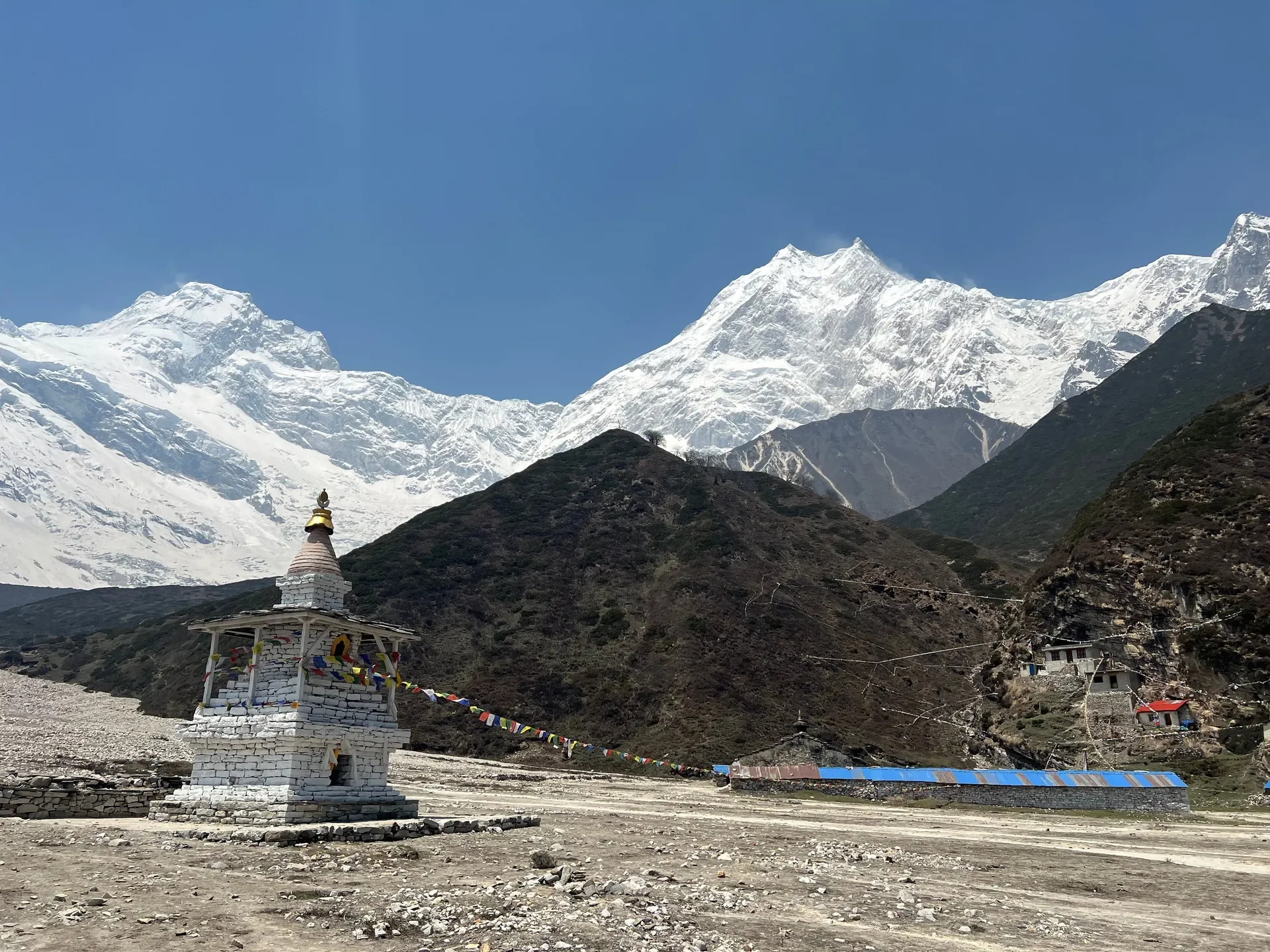
Source: Sanjay Prakash / Pexels, A serene Buddhist chorten stands against the dramatic backdrop of the Manaslu range, showcasing the rich cultural heritage found along the trail.
Dharamsala (also called Larkya Phedi) at 4,460 meters is the bleakest stop on the route. It is a cluster of basic stone-and-tin shelters with limited beds, no real village, and no ATM. Dorms fill fast in peak season, so your guide will often send a runner ahead from Samdo to hold space.
Eat well, hydrate hard, and sleep early. We tell trekkers to lay out every layer, fill water bottles overnight (insulated, so they do not freeze), and pre-pack the daypack before bed. Charging is solar-dependent and unreliable here, so arrive with full power banks.
Crossing Day: Step by Step
Crossing day is the longest and coldest of the trek, an 8 to 9 hour push of roughly 24 kilometers from Dharamsala over Larkya La and down to Bimthang. You start by headlamp in the dark, summit by late morning before afternoon winds build, then make a long, steep descent on the far side.
Section 1: Dharamsala to Larkya Phedi viewpoint
The first 2 hours climb gradually on a rocky trail beside the Larkya glacier moraine. It is dark, cold, and slow. Keep your pace deliberate. Talking is fine, but breathing comes first at this altitude.
Section 2: The glacier and the four lakes
The trail flattens across moraine and past a series of small frozen ponds. Here the gradient teases you with false summits. The wind picks up, and you will be glad of your buff and goggles.
Section 3: The final climb to the pass
The last push to 5,106 meters is short but steep, often over snow or hard ice. At the top, lines of prayer flags snap in the wind and the Annapurna range opens up to the west. Photos, a few breathless minutes, then move. You do not rest long at the high point.
Section 4: The descent to Bimthang
The far side is the part trekkers underestimate. It is a steep, knee-pounding drop of nearly 1,400 meters over loose scree and, often, snow. Trekking poles are essential. The descent eases into alpine meadows before you reach the lodges of Bimthang (3,720m) in the afternoon, tired and grinning.
Altitude Safety on the Pass
Larkya La is high enough that AMS is a genuine risk even with good acclimatization. Watch for headache, nausea, dizziness, and loss of appetite. If symptoms worsen, the only reliable treatment is descent, and the good news is that the entire crossing day ends much lower than it starts.
Prioritize vegetarian meals on the trail. Meat is carried up by foot or mule over days without refrigeration in this region, so we steer travelers toward fresh carbohydrates. The classic Dal Bhat, lentil soup, rice, and vegetable curry, gives clean, high energy and usually comes with free refills. It is the fuel that gets people over the pass.
Skip plastic bottled water entirely. Carry a reusable bottle paired with a UV purifier, a Sawyer squeeze filter, or chlorine dioxide drops. Bottled water is expensive on the trail, creates waste in a fragile conservation area, and is unnecessary when you can purify safely.
Cash, Connectivity, and Trail Costs
There are no ATMs anywhere on the Manaslu Circuit. Carry enough Nepalese Rupees (NPR) cash for the entire trek, withdrawn in Kathmandu before departure. Budget extra for the small upcharges that catch first-timers off guard.
Charging a phone or power bank: NPR 200 to 500 per device.
A gas-heated hot shower: NPR 300 to 700.
Localized Wi-Fi access: NPR 200 to 500.
For connectivity, Nepal Telecom (NTC) is the essential SIM in the Manaslu region. Coverage is patchy in the upper valley and disappears around the pass, so do not rely on a signal for navigation or emergencies. Your guide carries the responsibility for communication in remote zones.
Roads, Jeeps, and the Walking Trail
Be honest with yourself about the roads. Jeep tracks have crept up both ends of the circuit, with vehicles now reaching beyond Soti Khola at the start and up the Marsyangdi at the finish. Where possible, we route trekkers onto the older walking trails to avoid dust and traffic. The high section around Larkya La remains pure footpath, which is exactly why it stays special.
Cultural Etiquette on the Trail
The upper Manaslu valley is deeply Buddhist, with mani walls, chortens, and monasteries throughout Lho, Samagaun, and Samdo. Always walk clockwise around mani walls, stupas, and chortens, keeping these sacred structures on your right.
Remove your shoes and hats before entering any temple or monastery. Outdoor photography is fine, but photographing inside monastery prayer halls is prohibited unless a resident monk gives you explicit clearance.
Tipping Your Crew
Tipping is culturally expected and a meaningful supplement to the income of guides and porters who carry your gear over a 5,106-meter pass. A standard guideline is 10% to 15% of your total trek cost, distributed among the crew at the end of the journey. Hand it over personally with thanks.
Packing Essentials for the Pass
Category
Key Items
Crossing day layers
Down jacket, insulated gloves, buff, beanie, windproof shell
Footwear
Broken-in boots, microspikes for icy snow, gaiters
The reliable windows are spring (March to May) and autumn (late September to November), when skies are clear and snow on the pass is manageable. Read our seasonal comparison of September versus October and the wider October trekking guide to fine-tune timing.
Avoid the deep monsoon (June to August), when the lower Manaslu trail turns to mud and leeches. If summer is your only option, the rain-shadow regions of Upper Mustang and Upper Dolpo stay dry while the rest of Nepal floods. Winter crossings are possible but the pass can be blocked by heavy snow, and Dharamsala is brutally cold.
Frequently Asked Questions
How high is Larke Pass?
Larkya La sits at 5,106 meters (some signs list 5,160m). It is the highest point of the Manaslu Circuit, crossed in one long day from Dharamsala to Bimthang.
Can I trek the Manaslu Circuit solo in 2026?
No. As of the March 2026 DOI update, a single traveler can obtain a Restricted Area Permit, but you must hire a licensed guide. The guide ratio is capped at 1:7.
How long is the Larkya La crossing day?
Expect 8 to 9 hours covering about 24 kilometers from Dharamsala (4,460m) over the pass and down to Bimthang (3,720m).
Do I need crampons or microspikes for the pass?
In spring and late autumn, microspikes are strongly recommended for the icy snow near the top and on the steep descent. Your guide will advise based on current conditions.
Are there ATMs on the Manaslu Circuit?
No. Carry all your NPR cash from Kathmandu. There are no ATMs anywhere on the trek, and lodges charge cash for extras like charging and showers.
Which SIM card works best on the Manaslu trail?
Nepal Telecom (NTC) gives the most reliable coverage in the Manaslu region, though signal drops out in the upper valley and around the pass.
Is helicopter evacuation insurance required?
Yes. You need insurance covering emergency helicopter evacuation up to 6,000 meters and treatment for AMS, HAPE, and HACE. Proof is required to obtain the Restricted Area Permit.
What is the accommodation like at Dharamsala?
Basic stone and tin shelters with limited dorm beds, no village, and no electricity reliability. It is the most spartan stop on the route, so arrive early and self-sufficient.
Can I see Manaslu peak from the trail?
Yes. Mount Manaslu (8,163 meters), the world's eighth highest mountain, dominates the skyline from Lho, Samagaun, and the acclimatization hikes.
How does Larkya La compare to other high passes in Nepal?
It is lower than Annapurna's Thorong La (5,416m) but feels longer and more remote, with a steeper descent and fewer support facilities.