Standing at the top of Thorong La, you feel the thin air in every breath before the prayer flags even come into view. At 5,416 meters, this is the highest point on the Annapurna Circuit and, for most trekkers, the highest place they will ever walk to under their own power. It is a serious mountain pass, and crossing it safely is far more about preparation, patience, and acclimatization than raw fitness.
Our team of local coordinators and licensed guides has walked this route across every season, and the honest truth is that Thorong La punishes people who rush. This guide gives you the exact altitude data, current 2026 rules, the weather realities, and the hour-by-hour crossing plan we use to get trekkers over safely.
How High Is Thorong La Pass and Why It Matters
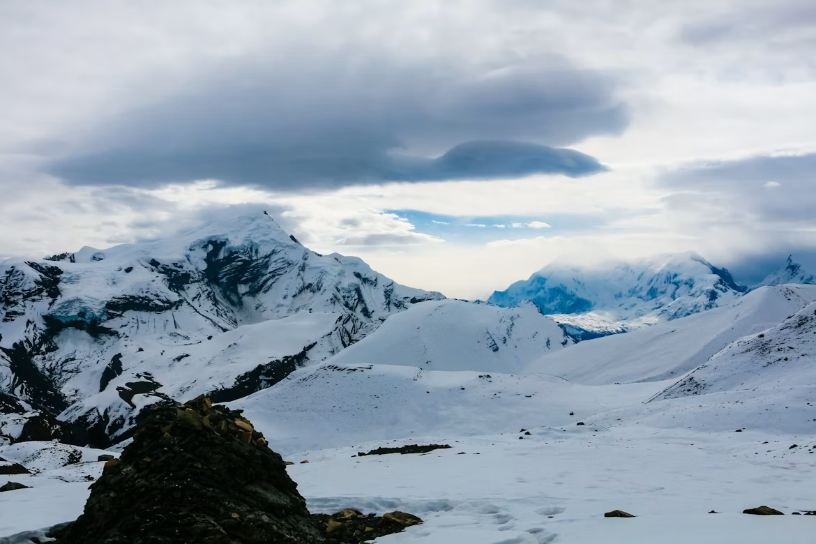
Source: Neha Maheen Mahfin, Snow covered mountains seen on the way to thorong la pass.
Thorong La Pass reaches 5,416 meters (17,769 feet), the highest point on the Annapurna Circuit. At this elevation, oxygen levels drop to roughly half of those at sea level. The pass connects the Manang valley in the east with the Mustang region and Muktinath in the west, and the real danger here is altitude, not technical climbing.
There is no rope work, no glacier travel, and no scrambling involved. The challenge is your body coping with extreme altitude over a long, cold, high-output day. People who treat Thorong La like an ordinary hill walk are the ones who get into trouble.
Key Elevations Along the Approach
A little inspiration for your next trip
Get travel ideas and local experiences from My Easy Guide in your inbox.
Spam free. Unsubscribe anytime. We respect your privacy.
Location
Elevation
Role
Manang
3,540 meters
Main acclimatization stop
Yak Kharka
4,050 meters
Intermediate sleep stop
Thorong Phedi (Base Camp)
4,540 meters
Pre-pass overnight
High Camp
4,880 meters
Optional higher overnight
Thorong La Pass
5,416 meters
The crossing point
Muktinath
3,800 meters
Descent destination
How Difficult Is the Thorong La Crossing?
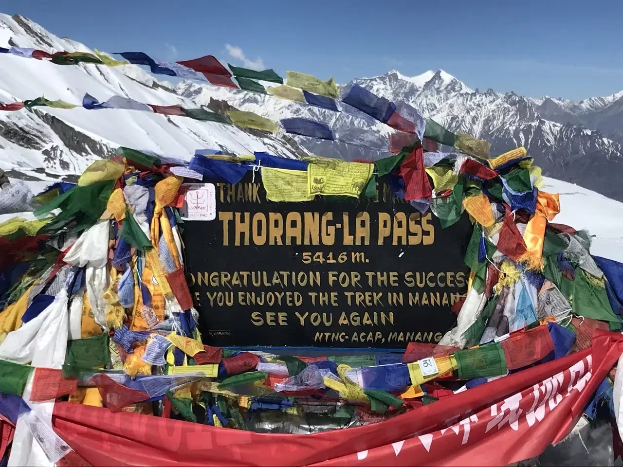
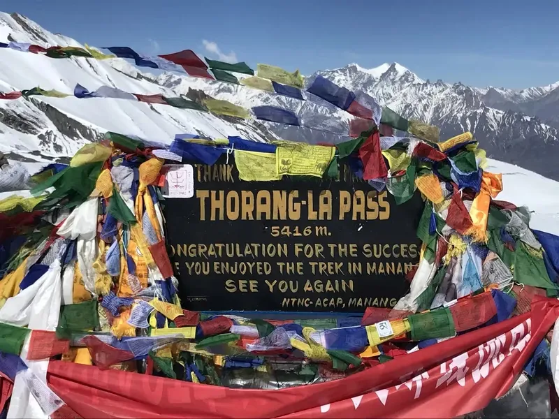
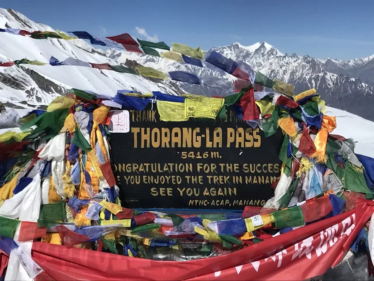
A signboard congratulating climbers on reaching the thorong la pass.
Thorong La is rated strenuous but non-technical. The difficulty comes from the altitude, the cold pre-dawn start, the long ascent of roughly 800 to 900 vertical meters, and a knee-pounding descent of over 1,600 meters to Muktinath. Most fit trekkers manage it with proper acclimatization, but it is unforgiving of poor preparation.
On crossing day you typically walk for 7 to 9 hours. The trail is a clear, well-worn path of dirt, rock, and often packed snow or ice near the top. There is nothing you scramble up with your hands, but every step at that altitude feels heavy and slow. The descent to Muktinath is steep and loose, which is why trekking poles save knees here.
Acclimatization: The Single Most Important Rule
Acclimatization guidelines generally recommend limiting sleeping elevation gains to around 300–500 m above 3,000 m. The Annapurna Circuit handles this well if you do not skip the acclimatization day in Manang. Crossing Thorong La too fast is the most common reason for evacuations.
We always build at least one full rest day at Manang (3,540 meters) before going higher. Use that day actively: hike up toward the Ice Lake or Gangapurna viewpoint and then sleep low. This "climb high, sleep low" approach trains your body before the big day.
Watch for Acute Mountain Sickness symptoms: headache, nausea, dizziness, and loss of appetite. If symptoms worsen, the only real cure is descent. Read our detailed breakdown of altitude sickness on Nepal treks and our guidance on using Diamox for high-altitude trekking before you go.
Yak Kharka vs High Camp: Where Should You Sleep?
Sleeping at Yak Kharka (4,050 meters) the night before, then Thorong Phedi (4,540 meters), gives a gentler altitude profile. High Camp (4,880 meters) shortens crossing day but is a hard place to sleep well. We generally favor Thorong Phedi for the better night's rest, even though it means a slightly longer summit morning.
2026 Permits and Regulations for Thorong La
The Annapurna Circuit is not a Restricted Area, so it does not require a special Restricted Area Permit. You need two documents: the ACAP permit and the TIMS card. Carry physical copies and your passport, as multiple checkpoints verify both along the route.
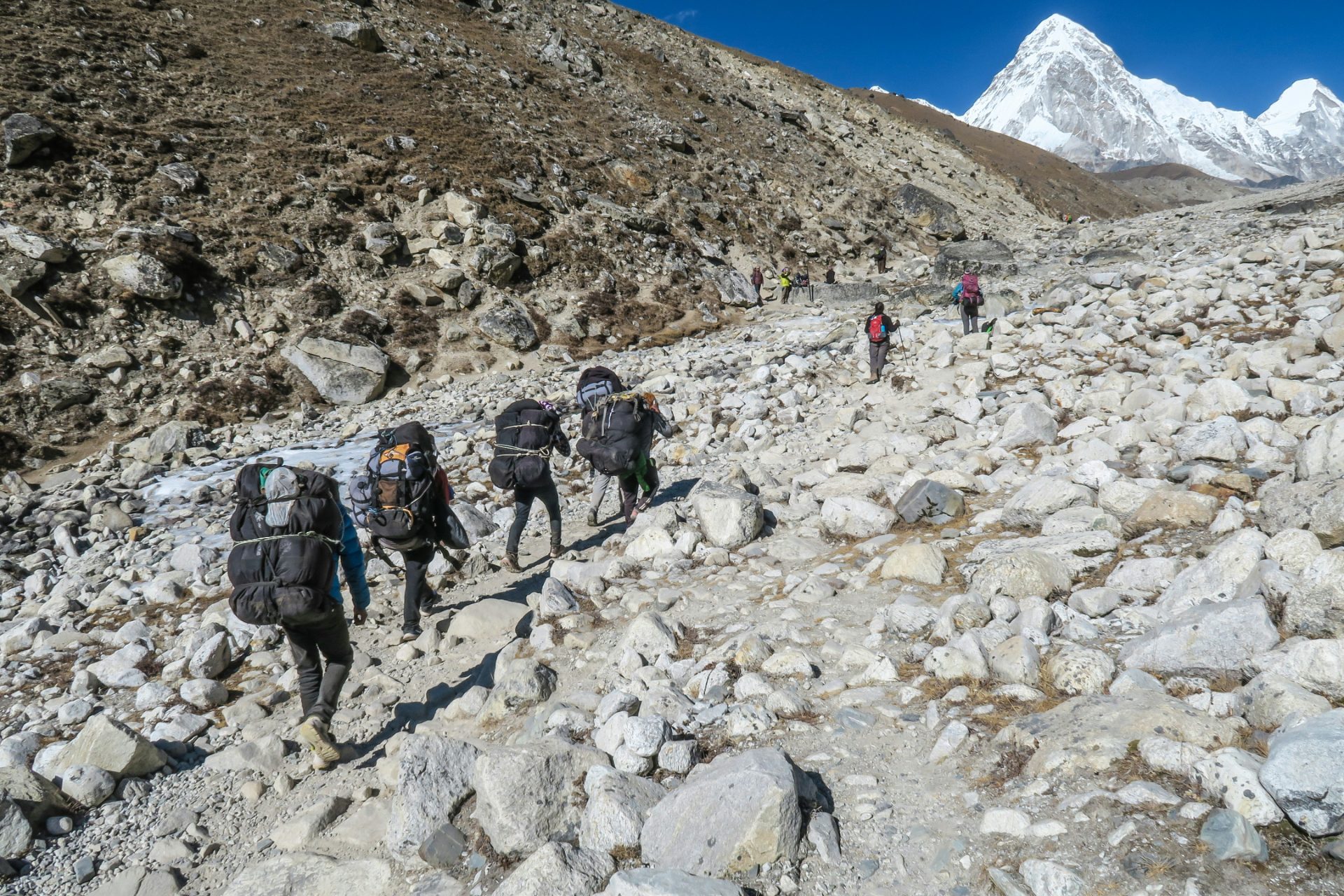
Source: Sebastian Pena Lambarri, Local Sherpa guides carrying load on a rugged mountain pass along a Nepal trekking route.
According to the Nepal Tourism Board's revised trekking provisions, the Annapurna Circuit is one of the routes where trekkers are expected to be accompanied by a licensed guide and carry a TIMS card. While the Annapurna Circuit is not a restricted zone like Manaslu or Upper Mustang, we strongly recommend a licensed guide for Thorong La. The pass is exposed, weather changes fast, and having someone who reads altitude symptoms and routes is genuine safety insurance. Always verify the current rules before you depart.
Best Time to Cross Thorong La Pass
The two prime windows are autumn (late September to November) and spring (March to May). These months offer stable weather, clear mountain views, and manageable trail conditions. Winter and monsoon both carry serious, distinct risks at the pass.
Season
Conditions
Verdict
Autumn (Sep-Nov)
Clear skies, cold mornings, stable
Best overall
Spring (Mar-May)
Warmer, some afternoon cloud
Excellent
Winter (Dec-Feb)
Heavy snow, pass often closed
High risk
Monsoon (Jun-Aug)
Rain, leeches lower down, mud
Avoid the pass
One important nuance: while the monsoon makes the lower circuit wet and slippery, the upper sections approaching Mustang lie partly in the Himalayan rain shadow. If your heart is set on summer trekking in a dry zone, consider Upper Mustang instead. For seasonal planning, our guides on trekking in October and September vs October compare the autumn window in detail.
The Crossing Day: Hour by Hour
Crossing day starts in the dark. From Thorong Phedi or High Camp, you leave between 4:00 AM and 5:00 AM by headlamp. The early start is non-negotiable: it lets you reach the pass before the punishing afternoon winds pick up and gives you daylight for the long descent.
The ascent is a slow, steady grind on switchbacks. Walk at a rhythm where you can still breathe through your nose and speak in short phrases. The cold at the top can be brutal, often well below freezing with wind chill, so layer properly. Reaching the prayer-flag-draped pass at 5,416 meters usually takes 3 to 4 hours from High Camp.
Do not linger long at the top. The descent to Muktinath (3,800 meters) drops more than 1,600 meters over steep, loose ground and takes another 3 to 4 hours. This is where poles and good knees matter. Most trekkers reach Muktinath by mid-afternoon, tired but elated.
Avoiding the Jeep Road
The Annapurna Circuit now has jeep roads in many lower sections, bringing dust and traffic. Whenever possible, use the dedicated NATT (New Annapurna Trekking Trails) walking paths that run parallel to the road. Your guide knows these alternates, and they make a huge difference to the quality of your walk.
Cash, Connectivity, and Trail Costs
ATMs effectively run out past Jomsom and the upper villages, so carry enough Nepalese Rupees in cash for the entire high section. Budget extra for the small charges that add up on the trail.
Lodges rarely include extras in the room rate. Expect to pay roughly 200 to 700 NPR per service for charging a power bank or phone, a gas-heated hot shower, or Wi-Fi access. These costs climb with the altitude.
Nepal Telecom (NTC) generally provides the most reliable coverage, while Ncell coverage varies between villages. Pick up a local SIM in Kathmandu or Pokhara before you start.
Insurance: Helicopter Evacuation Is Essential
Standard travel insurance is not enough for Thorong La.Comprehensive insurance covering high-altitude trekking and helicopter evacuation up to 6,000 meters is strongly recommended. Confirm the altitude clause in writing.
At 5,416 meters, a serious altitude emergency means a helicopter is often the only fast way down. Without the right coverage, an evacuation can cost thousands of dollars out of pocket. This is the one piece of paperwork we never let a trekker skip.
Eating and Drinking Safely at Altitude
Pure Himalayan comfort: A delicious and authentic Nepalese Dal Bhat platter.
We always advise prioritizing vegetarian meals on the trail. Up high, all meat is carried in by foot or mule over days without refrigeration, so the freshest, safest fuel is the traditional Dal Bhat: lentil soup, rice, and vegetable curry, usually with free refills. It is clean, high-energy, and exactly what your body wants on crossing day.
For water, please skip plastic bottles. Carry a reusable bottle paired with a UV purifier, a Sawyer squeeze filter, or chlorine dioxide drops. It protects the fragile mountain environment and keeps you reliably hydrated, which directly helps with altitude. Learn more about teahouse food on Nepal treks.
What to Pack for the Pass
The cold at the top is the biggest gear challenge. You need genuine insulation for the pre-dawn start and reliable layers you can shed as you descend into Muktinath's warmer air.
Insulated down jacket and warm hat plus a buff for the summit cold
Waterproof shell layers for wind and surprise snow
Sturdy broken-in boots and gaiters for snow patches
Trekking poles for the steep descent to Muktinath
Headlamp with spare batteries for the dark start
Sunglasses and high-SPF sunscreen for glare on snow
Sufficient NPR cash and a water purification system
This is a deeply Buddhist region, and small gestures of respect mean a lot. Always walk clockwise around mani walls, stupas, and chortens, keeping these sacred structures on your right side. The villages near Muktinath are especially significant pilgrimage sites.
When you visit monasteries, remove your shoes and hat before entering. Outdoor photography is fine, but always ask permission before taking photographs inside monasteries or prayer halls.
At the end of your trek, tipping your crew is culturally expected and a vital part of their income. A standard range is 10% to 15% of your total trek cost, distributed among your guide and porters.
How Thorong La Fits the Wider Circuit
The full Annapurna Circuit takes roughly two weeks, with Thorong La as its dramatic high point. Many trekkers extend the route with a side trip to Tilicho Lake, one of the highest lakes in the world and an excellent acclimatization detour. The descent to Muktinath also opens the door to the spiritually important Muktinath Temple.
If you want a deeper look at the crossing itself and the surrounding logistics, our dedicated Thorong La Pass trek guide covers the day-by-day itinerary in full. For first-time high-altitude trekkers comparing options, the Annapurna vs Everest Base Camp comparison is a useful starting point.
Final Safety Reminders
Thorong La rewards humility. Acclimatize properly, never skip the Manang rest day, start early, watch your symptoms honestly, and descend the moment things feel wrong. The pass will still be there next season; pushing through serious altitude symptoms is never worth the risk.
With the right preparation, a licensed guide, and respect for the mountain, crossing Thorong La becomes one of the most rewarding days of trekking anywhere in Nepal.
Frequently Asked Questions
How high is Thorong La Pass?
Thorong La Pass sits at 5,416 meters (17,769 feet), the highest point on the Annapurna Circuit and one of the highest trekking passes regularly crossed by non-mountaineers.
Do I need a guide to cross Thorong La in 2026?
The Annapurna Circuit is not a Restricted Area, but Nepal strongly enforces licensed guide rules across major regions. We strongly recommend a licensed guide for Thorong La given the altitude, weather, and route risks. Verify current rules before departure.
What permits do I need?
You need the ACAP permit (NPR 3,000 for foreigners) and the TIMS card (NPR 2,000 for foreigners). SAARC nationals pay reduced rates.
How long does the crossing day take?
Expect 7 to 9 hours total: roughly 3 to 4 hours up to the pass and another 3 to 4 hours down to Muktinath.
What time should I start?
Leave between 4:00 AM and 5:00 AM to beat the strong afternoon winds and allow daylight for the long descent.
Is Thorong La technically difficult?
No. There is no climbing, rope work, or glacier travel. It is a strenuous, non-technical walk made hard by altitude, cold, and distance.
Which direction should I cross the pass?
Almost everyone crosses west, from Manang toward Muktinath. This direction gives a gradual acclimatization profile and a shorter, safer ascent on summit day.
Can I get altitude sickness on Thorong La?
Yes. AMS is a real risk above 3,000 meters. Follow the 300 to 500 meters daily sleep-gain rule, take the Manang rest day, and descend if symptoms worsen.
Are there ATMs near the pass?
No. ATMs effectively disappear past Jomsom and upper villages. Carry enough NPR cash for the entire high section, including trail upcharges.
What network works best?
Ncell gives the strongest coverage on most of the Annapurna Circuit, with Nepal Telecom (NTC) as a useful backup in remote pockets.
What kind of insurance do I need?
A policy that specifically covers high-altitude helicopter evacuation up to 6,000 meters and treatment for AMS, HAPE, and HACE. Confirm the altitude clause in writing.
Can I cross Thorong La in winter?
It is high risk. Heavy snow frequently closes the pass between December and February. Autumn and spring are far safer windows.